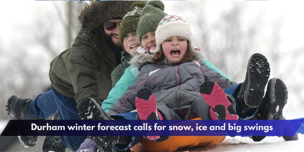
Durham Region residents could face a changeable winter marked by snow, freezing rain, thaws and sudden temperature swings, according to one early outlook for the 2026–27 season.
The Durham winter forecast is based partly on the Farmers’ Almanac’s newly released Canadian winter outlook, which predicts frequent snow, lake-effect snow and icy conditions across Ontario.


However, official seasonal forecasts currently suggest southern Ontario could also experience a generally milder-than-normal winter, making it important to treat individual snow and ice predictions cautiously.


Farmers’ Almanac predicts a changeable Ontario winter
The Farmers’ Almanac describes winter 2026–27 as a season of “snow, sleet and surprises,” with Ontario positioned near an active boundary between cold air and incoming storm systems.
Its Ontario forecast calls for frequent snow opportunities, lake-effect snow, freezing rain and repeated freeze-thaw cycles.
Southern Ontario storms could move between snow, rain and freezing rain when temperatures remain near 0 C, according to the outlook. Sudden colder air following rain or melting snow could also create flash-freeze conditions.
For Durham Region, that type of pattern could mean considerable variation from one storm to another rather than continuous deep cold or uninterrupted snowfall.
The Almanac outlook is a long-range prediction and should not be interpreted as a detailed forecast for individual Durham municipalities months in advance.
Very strong El Niño is developing
A major factor meteorologists are watching is El Niño.
NOAA’s Climate Prediction Center confirmed on Aug. 13 that El Niño is strengthening in the tropical Pacific Ocean.
The agency says there is now a greater than 90 per cent chance of a very strong El Niño during the Northern Hemisphere fall and winter of 2026–27.
NOAA also estimates a 69 per cent chance that the October-to-December event could reach a level exceeding previous El Niño events in its historical record dating to 1950.
But even an exceptionally strong El Niño does not guarantee a particular winter outcome in Durham or elsewhere in Ontario. NOAA specifically cautions that stronger El Niño conditions only increase the odds of certain weather patterns; they do not ensure them.
Environment Canada currently leans warmer
Environment Canada’s seasonal forecast provides useful context for the Durham winter forecast.
Its current December 2026 through February 2027 outlook for Toronto favours temperatures above the historical normal, with a probability in the 50-to-59-per-cent range.
The same outlook currently shows near-normal precipitation as the most likely category for Toronto, although Environment Canada rates the historical skill of that particular precipitation forecast as low.
That does not mean Durham will avoid snowstorms or freezing rain.
Seasonal forecasts describe average conditions across several months. A winter that averages warmer than normal can still produce significant snowfalls, ice storms and short periods of severe cold.
What it could mean for Durham Region
Durham stretches from the Lake Ontario shoreline to rural communities farther north, so winter conditions can vary considerably across the region.
Pickering, Ajax, Whitby, Oshawa and Clarington could experience different snowfall totals than northern municipalities such as Uxbridge, Scugog and Brock during individual storms.
Lake-effect snow is also highly dependent on wind direction, lake temperatures and the precise location of narrow snow bands, making exact local impacts impossible to determine this far ahead.
For now, the main message from the competing forecasts is variability.
The Farmers’ Almanac expects an active mix of snow and ice, while official climate guidance suggests a very strong El Niño and increased odds of above-normal seasonal temperatures.
The Durham winter forecast will become considerably clearer as Environment Canada updates its seasonal outlook and shorter-range forecasts become available later in the fall.
Residents should rely on Environment Canada watches, warnings and local forecasts when individual winter storms approach rather than using a months-ahead seasonal outlook for travel or safety decisions.