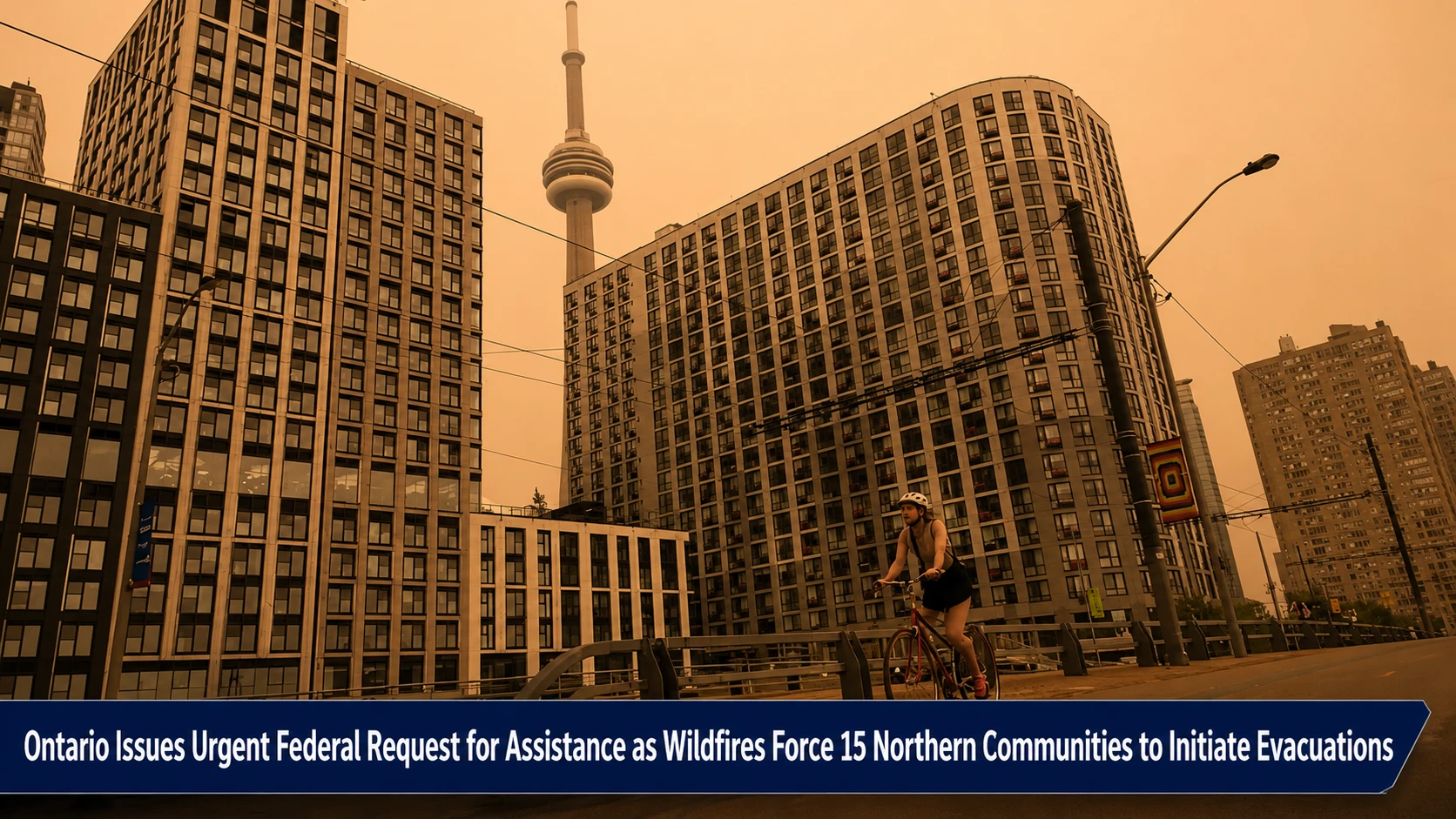
The national emergency operations centers, provincial disaster response frameworks, and public health command panels within the Durham Region are coordinating emergency safety logs. Tracked under federal-provincial emergency management, natural resource logistics, and public health risk portfolios on Thursday, July 16, 2026, disaster mitigation analysts finalized the high-priority security overview The latest on Ontario wildfires and smoke, from evacuations to poor air quality. With strong northwest wind vectors rapidly fanning massive, unpredictable fire walls across northern development sectors, the Government of Ontario has officially activated an emergency Request for Assistance (RFA) to the federal government. The formal decree demands immediate military aviation assets to stand ready as broad plumes of toxic particulate matter sweep down to paralyze the southern industrial core.
Emergency planning directors emphasize that because fire boundaries are shifting with extreme velocity, cross-country mutual aid deployment loops have been accelerated to prevent mass casualties.
The Inter-Provincial Air Armada and the First Nations Emergency Corridor
The evolving wilderness emergency has forced an unprecedented alignment of federal, provincial, and private transport operations to manage severe risk variables:
-
The Alberta Tactical Inflow: Fighting severe flare-ups, Alberta Wildfire teams have rushed critical support eastward, deploying 94 specialized forest firefighters and a fleet of 13 aircraft to Ontario’s frontlines. This emergency tactical fleet includes two massive water bombers, six localized air tankers, and two helicopter tankers.
-
The 24-Hour Evacuation Mandate: Ontario Emergency Preparedness Minister Jill Dunlop directed a high-priority brief to federal authorities, demanding that aircraft and military crews be ready to deploy in 24 hours or less. This deployment is aimed at conducting emergency airlifts across 15 northern First Nations communities currently executing or actively planning full structural evacuations.
-
The Namaygoosisagagun Crisis: Highlighting the extreme destruction in the north, a fast-moving blaze breached the perimeter of the Namaygoosisagagun First Nation (also known as Collins First Nation) north of Thunder Bay, destroying several family residences and municipal structures.
-
The CN Rail Line Ambush: Demonstrating the immediate danger to transport logistics, a Teamsters union crew operating a Canadian National (CN) Railway freight line near Armstrong was caught in an active burn zone. After viral social media footage captured towering walls of fire closing in on both sides of the tracks, the crew had to be treated for acute smoke inhalation, prompting CN to completely suspend operations across the corridor.
Analyzing the Cross-Jurisdictional Resource Grid and Atmospheric Risk Matrix
The wildfire emergency links federal coordination packages with high-risk air monitoring grids stretching across the province.
| Crisis Operational Sector | Active Regulatory / Response Agency | Deployed Tactical Assets & Personnel | Immediate Public Health & Safety Threats | Long-Term Weather Stabilization Outlook |
|
Northern Fire Zones (Catchment: Armstrong / Thunder Bay) |
Aviation Management & Ontario Forestry Command |
• 94 incoming Alberta fire personnel. • 13 mutual aid aircraft. • 4 federally funded helicopters. |
Complete loss of residential structures, trapped rail corridors, and community isolation. | Strong northwest winds continue to fan volatile lines into dry fuel beds. |
| Federal Resource Grid | Public Safety Canada & Minister Eleanor Olszewski | 24-hour military standby assets alongside First Nations emergency support. | Interrupted supply paths, delayed communications, and logistical bottlenecks. | Continuous evaluation of emergency requests for Canadian Armed Forces personnel. |
| Southern Ontario Air Basin | Environment and Climate Change Canada | Real-time monitoring grids tracking fine particulate matter metrics. | “Very High Risk” air quality index stretching from Windsor fully to Kingston. | Inversions are modeled to remain highly toxic before a clearing wind shift Friday morning. |
The Federal Strategic and Community Health Protection Directives
“The situation may continue to escalate rapidly,” stated Ontario Emergency Preparedness Minister Jill Dunlop in her urgent appeal to the federal government, underscoring that public resources must remain fluid to ensure absolute readiness. Federal Emergency Management Minister Eleanor Olszewski confirmed that Ottawa is working around the clock to provide the material support needed to protect isolated northern residents. Meanwhile, public health directors in southern cities warn that the visible orange haze carrying thick smoke plumes across GTHA skies represents a severe health hazard. Older adults, pregnant individuals, and people with respiratory conditions are strongly urged to keep internal building openings sealed and completely avoid outdoor physical exertion until the smoke fields clear.
The Ministry of Natural Resources and Forestry, the Teamsters Canada Rail Conference, the Emergency Management Ontario Command Group, and individual regional public health medical officers handle ongoing fire line containment, evacuation logistics, and air health indexing.
Durham residents, international logistics dispatchers, and community health organizers looking to view real-time satellite fire boundary maps, download updated air quality health indexes for Oshawa and Whitby, or track emergency evacuation flight paths can find the tools online through the central Ontario Wildfire tracking portal at www.ontario.ca/forestfires, check federal response progress via the Public Safety Canada dashboard, or monitor local environmental notices through the Durham Region safety hub.