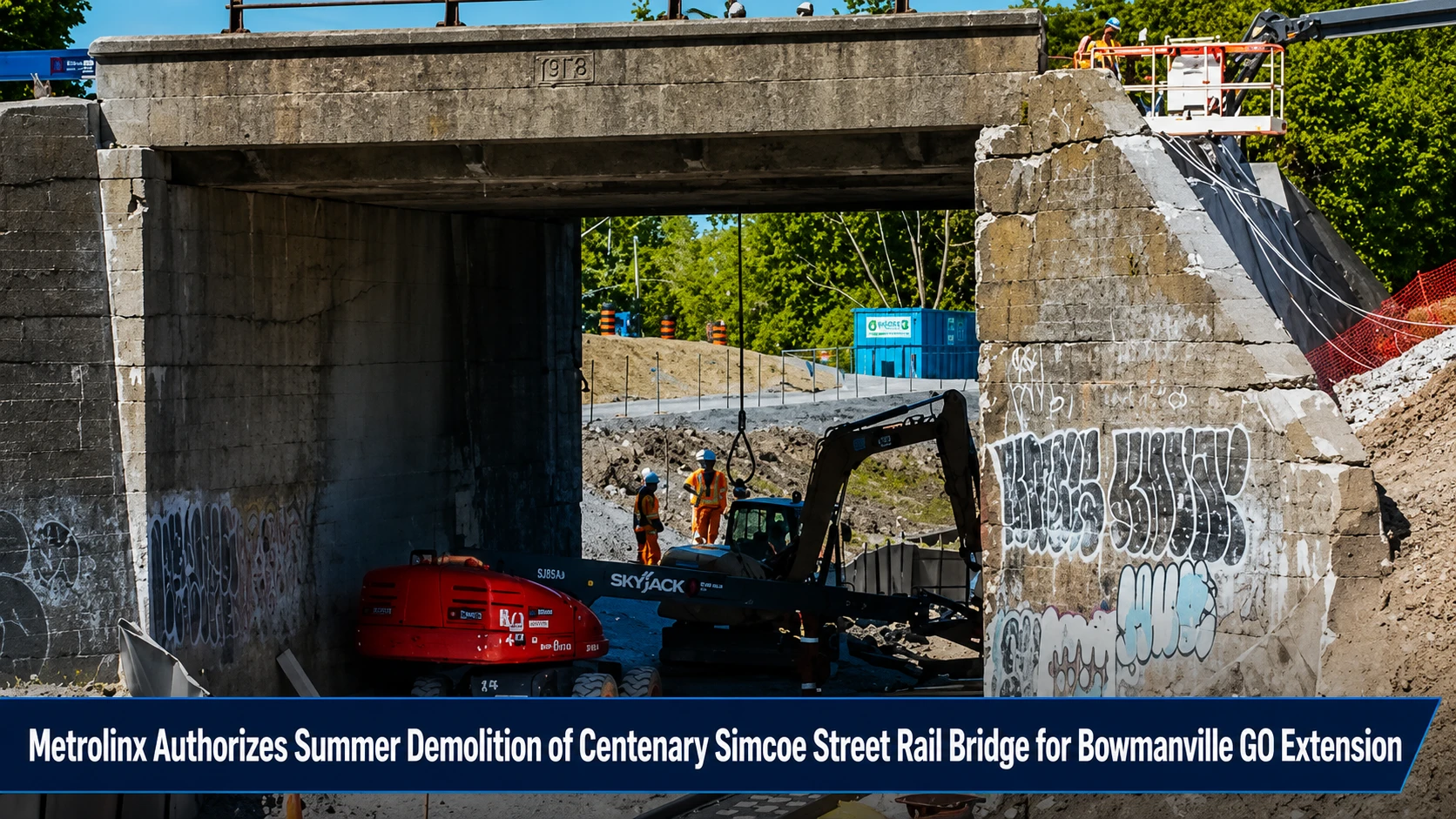
The transit planning bureaus, municipal public works panels, and urban grid engineers within the Durham Region are coordinating a massive infrastructure intervention. Tracked under provincial transit expansion, regional road layout overhauls, and municipal traffic alerts on Thursday, July 16, 2026, transportation logistical networks finalized the project update Simcoe rail bridge to be demolished this summer. Provincial transit agency Metrolinx confirmed that crews are beginning the systematic teardown of the historic, 100-plus-year-old overhead bridge spanning the Canadian Pacific Kansas City (CPKC) railway track. The complex structure is being completely cleared away to build a modern, high-capacity crossing.
While the engineering upgrade is essential for extending the Lakeshore East GO line deeper into Durham, local authorities and area residents are bracing for massive traffic bottlenecks.
The Multi-Year Construction Block and Traffic Chaos Indicators
The regional demolition plan establishes a heavy structural footprint that will alter regional travel patterns for months to come:
-
The Centenary Structural Removal: Piece by piece, the century-old steel and concrete overpass is being systematically cut out and lowered through the summer season to carve out space for a new rail corridor underneath.
-
The Two-Year Target Timeline: Construction operations began early this year and are modeled to require up to two full years of continuous activity before the new bridge comes online, subject to seasonal weather anomalies.
-
The Gridlock Inversion Risk: Local area councilors and municipal traffic engineers have issued strong public warnings regarding building traffic patterns. Regional travel routes are already heavily strained by concurrent roadwork from the Ontario Ministry of Transportation (MTO) and the Regional Municipality of Durham.
-
The Non-Weekend Policy Friction: The project has drawn local political criticism due to current contract scheduling frameworks that skip weekend shifts, a move that critics argue extends the overall community disruption window.
Analyzing the Simcoe Bridge Project Specifications and Traffic Impact Matrix
The structural transformation requires highly precise coordination across multiple parallel transit frameworks.
| Engineering Milestone Phase | Target Project Execution Window | Primary Rail Systems Affected | Associated Local Traffic Headwinds | Strategic Regional Expansion Objective |
| Active Structure Demolition |
Summer 2026 Baseline (Currently executing) |
CPKC Railway Line Network: High-density freight corridor operating below the deck. |
• Simcoe Street lane reductions. • Diversion of baseline delivery logistics. • Heavy arterial congestion. |
Clears structural clearance blocks to allow new commuter tracks to pass underneath. |
| New Bridge Construction | Running through Late 2027 / Early 2028 | GO Transit Regional Grid: Adapting local frameworks for long-term expansion lines. |
• Compounding delays with active MTO projects. • Peak hours shortcut pressure. |
The Bowmanville Extension: Integrates Clarington seamlessly into the GTHA rail grid. |
The Metrolinx Operational and Regional Commuter Directives
“This is one of many major infrastructure upgrades happening across Durham Region, as part of the Bowmanville Extension. Demolition continues through the summer, making room for a new, modern bridge and a new rail line underneath,” Metrolinx stated in its project brief Big changes at Simcoe Bridge. Local neighborhood coordinators emphasize that because Simcoe Street operates as a vital north-south commercial pipeline through Oshawa’s downtown core, motorists must start altering their travel habits immediately. Commuters are strongly urged to rely on regional bypass options like Ritson Road or Stevenson Road, budget an extra 20 to 30 minutes for cross-town trips, and exercise extreme caution when navigating near active heavy equipment zones.
The Metrolinx Project Management Office, the Canadian Pacific Kansas City Railway Dispatch Circle, the City of Oshawa Public Works Division, and individual regional traffic compliance leads handle ongoing staging, site safety management, and perimeter detour mapping.
Oshawa commuters, transport logistics managers, and local business owners looking to view live progress clips of the bridge extraction, download updated arterial detour maps, or read detailed transit progress timelines can locate the data online through the central Metrolinx Bowmanville Extension dashboard at www.metrolinx.com/bowmanville, track local road delays via the Durham Region construction hub, or check regional transit maps through the City of Oshawa public works network.